
 |
The western cliffs of West Rock Ridge rise steeply from Woodbridge. |

- Directions: From Rt. 15, take Exit 50 (formerly Exit 60), and turn right to head south on Rt. 10 (Dixwell Avenue) for 0.3 miles. At the next traffic light past the parkway, turn right on Benham Street and take this to the end (2 miles). Then turn left on Main Street and head south for 0.9 miles. At the turn in the road, turn right into the parking area. This paved parking lot holds 28 cars and often fills up on a good weather weekend. The center parking spaces are shorter than a standard parking space and are best used by compact cars.
- Alternatively, those driving on Route 15 North, may wish to take Exit 46 (formerly Exit 59), especially if there is a traffic backup leading to the tunnel. While using Exit 50 is a longer drive, the drive from Exit 50 is more pleasant because there are far fewer traffic lights involved.
- From Exit 46, head south on Rt. 69 to the merge with Rt. 63 South and continue to Blake Street (1.1 miles). Turn left on Blake Street, then left at the traffic light onto Springside Avenue. At the stop sign past the New Haven Job Corps, turn left on Wintergreen Avenue. Go past the main entrance and the overpass for Route 15, go around the sharp bend, and up the hill to Main Street, just past Wintergreen School. Turn left on Main Street (Look for a small wooden "Lake Wintergreen" sign on the telephone pole). At the bottom of the hill, head straight into the parking lot. (Do this carefully because this is a blind curve and cars coming from the other direction can easily surprise you.)

When driving from Wintergreen Avenue toward Lake Wintergreen, this sign reminds people to turn onto Main Street. |
 |
The closed gate to the Lake Wintergreen overflow parking area, as seen on Jan. 6, 2024. |
 | ||
The Wintergreen Interdistrict Magnet School is located at 670 Wintergreen Ave., Hamden, as seen on Jan. 6, 2024, Its northern driveway is nearly across from the West Rock overflow parking lot.
|

 |
The sign on the Red Trail, 0.1 miles south of the Lake Wintergreen parking lot, indicates the wide path to the overflow parking lot at 635 Wintergreen Ave., Jan. 6, 2024. |
These are safer option than trying to park along the shoulder of Main Street as people commonly do. There is no risk of being clipped by a passing vehicle trying to squeeze past. For the people exiting the cars, they are not standing in the brush on the passenger side, or in the travel lane on the driver’s side.
 |
Motorists taking Exit 50 (f0rmerly Exit 60) off the Wilbur Cross Parkway are directed to head south along Route 10 (Dixwell Avenue) to access West Rock Ridge State Park. This sign is located on the exit ramp from Rt. 15 North, as seen on July 31, 2025. |
 |
Approaching the traffic light at Benham Street, this sign on Route 10 South (Dixwell Avenue) advises people to turn right. |
 |
| Benham Street ends at a T-intersection with Main Street. Turn left to continue toward Lake Wintergreen and the main entrance. The sign says "Wintergreen Lake" because the lettering fits better over the image of cartop boating than writing "Lake Wintergreen." |
- Westville Center, 495 Blake St., New Haven: A popular meeting place, which is located outside the park boundaries, is the parking lot behind the red brick building, 495 Blake St., New Haven, at the corner of Valley Street. The Elm City Montessori School is the current main tenant of this building. From Blake Street, the brick smokestack (not in operation) with the wording "Blake St. Center" is clearly visible. The parking lot is associated with the building, but parking is readily available in the spaces by the pedestrian footbridge over the West River. Along the river, there are about 20 parking spaces, and more spaces closer to the buildings.
 |
The sign on Route 15 North (Wilbur Cross Parkway) shows the new exit number for Routes 69 and 63, formerly known as Exit 59 and now known as Exit 46 because the exit is about 46 miles from the New York State line, as seen on July 31, 2025. |
 |
The sign on Route 15 North (Wilbur Cross Parkway) at the exit ramp shows the new exit number for Routes 69 and 63, formerly known as Exit 59 and now known as Exit 46, as seen on July 31, 2025. |
- Directions: From Rt. 15, Exit 46 (formerly Exit 59), head south on Rt. 69 to the merge with Rt. 63 South and continue to Blake Street (1.1 miles). Turn left on Blake Street, then left again at the first traffic light onto Valley Street, then right into the parking lot.
- To access the Westville Feeder from this parking area, walk over the pedestrian bridge that crosses the West River. After the bridge, turn left and follow the dirt path alongside the field, following the Blue-Yellow blazes. The Westville Feeder ends at the Blue-Blazed Regicides Trail. At the junction, turn left to head north to Judges Cave, or turn right to head south toward the South Overlook. From the South Overlook, descend on the Red Trail. At the base of the descent, the Red Trail turns left. Continue straight another 100 feet, then turn right onto an unmarked trail to return to the ballfield and parking area.
 |
This photo shows only a small portion of the parking area at Blake and Valley Streets, behind the brick building at this intersection. These spots are directly in front of the pedestrian bridge where the Westville Feeder Trail starts. |
- West Rock Nature Center, 1080 Wintergreen Ave., Hamden: There is potentially parking for about 10 cars in the lot on Wintergreen Avenue by the Rt. 15 overpass, depending on where New Haven sets the Jersey barriers. Some years the full parking is available. Other times, the Jersey barriers are moved close to the road in an attempt to limit the amount of illegal dumping that takes place and to make it more difficult for illegal dumpers to throw items down into the ravine, from where it is challenging to remove. I know because another volunteer and I in 2019 carried a clothes dryer and a circular fan up to the road for the city to remove, which it did.
- Throughout most of 2025, the area was fully blocked off. However, in late October 2025, the barriers had been pushed back and the lot was fully open. As detailed below, use of this parking area is NOT recommended. It is better to park at Lake Wintergreen.
- Guidebooks that discuss West Rock often suggest parking in the West Rock Nature Center parking lot on Wintergreen Avenue at the Wilbur Cross Parkway overpass. However, due to the risk of smash and grab theft, I do not recommend parking in this area. The exception would be a quick trip to Wintergreen Falls, which is located two hundred feet away in the woods, using the trail to the left of the parking lot.
- New Haven also owns the parking lot adjacent to the main entrance that is permanently blocked off by a chain (unless open for a special program) for the same reason. At times people break this chain and use the lot for dumping, and when it is open responsible users park in the lot. In the past when this was open, I found broken window glass in this parking lot, hence the recommendation to park elsewhere.
- Directions: From Rt. 15, Exit 46 (formerly Exit 59), head south on Rt. 69 to the merge with Rt. 63 South and continue to Blake Street, about 1.1 miles. Turn left on Blake Street for 0.3 miles, and then left onto Springside Ave. for 0.8 miles. At the stop sign, turn left onto Wintergreen Ave and go 0.3 miles.
 |
The amount of parking at the lower parking lot for the West Rock Nature Center varies. New Haven moves the barriers to make the parking lot smaller, as seen her on April 6, 2024, due to the illegal dumping that plagues the area. In the below photo, the barriers had been pushed back. |
 |
The West Rock Nature Center lower parking lot is located near the overpass for the Wilbur Cross Parkway, as seen on Dec. 28, 2023. The barriers were in this same location in October 2025. |
- Hill Street/Farm Brook Reservoir, 610 Hill St., Hamden: There is an unmarked gravel lot for five cars at 610 Hill Street, Hamden, 0.15 miles south of West Shepard St. This lot is the closest access for people fishing at Farm Brook Reservoir, a flood control pond near Hill Street. The Red-White Trail starts here and leads up the ridge to the Red Trail, which then connects to the Regicides Trail.
- Directions from the North: From Rt. 15 Exit 52 (formerly Exit 62), turn right and head north on Whitney Avenue for 0.3 miles. Left at the light on Route 10 South for 0.6 miles. Right at the light on Sanford St. for 0.4 miles. Right on at the light on Shepard Ave. for 1.4 miles. Left at the light on West Shepard Ave. for 0.9 miles. Left on Hill St. at stop sign and go 0.2 miles to parking lot. If the parking lot is full, park along the road.
- Directions from the South: From Rt. 15 Exit 50 (formerly Exit 60), turn right and head south on Rt. 10 to the first light. Right on Benham St. for 1 mile. Right on Paradise Ave. at the light, then quick right to stay on Paradise Ave. for 1.5 miles. Left on Hill St. at stop sign and go 1.2 miles to parking lot. If the parking lot is full, park along the road.
 |
The Hill Street parking area provides direct access to the Red-White Trail, leading to the Red Trail, and Farm Brook Reservoir. The state replaced the fence at the Hill Street parking lot in August 2015. |
 |
The state installed this signboard near the Hill Street parking lot in spring 2017. The signboard is adjacent to the woods. The kiosk has the 2016 version of the map in spring 2024. The main difference between the two maps is that the Blue-White Trail seen on the 2023 map has the previous color of Gold on the 2016 map. |
- 645 Mountain Road, Hamden: There is a unmarked gravel lot for four cars on Mountain Road, across from 648 Mountain Road. This lot may be used to access the Yellow Trail, which is 0.30 miles west on Mountain Road, or the Red Trail, which is 0.10 miles east on Mountain Road.
- Directions:
 |
This small unmarked parking lot at 645 Mountain Rd.
provides access to the Red Trail and the Yellow Trail. |
- 560 West Shepard Avenue (by Rayzoe Terrace), Hamden: Street parking is available on West Shepard Avenue, just west of Hill Street, by the gate near Rayzoe Terrace. This address is for an undeveloped property and may not be recognized by GPS. An alternative address is 550 West Shepard Ave., which is the house across the street. There is room for 20 or more cars along the roads here.
- Directions from the North: From Rt. 15 Exit 52 (formerly Exit 62), turn right and head north on Whitney Avenue for 0.3 miles. Left at the light on Route 10 South for 0.6 miles. Right at the light on Sanford St. for 0.4 miles. Right on at the light on Shepard Ave. for 1.4 miles. Left at the light on West Shepard Ave. for 1.1 miles. Park along the street near the gate on the same side of West Shepard Avenue as the park.
- Walk up the road past the gate and you will access Baldwin Drive past a large pile of rocks and dirt. If you continue straight, the abandoned Sanford Road will soon connect with the Sanford Feeder and crosses the Regicides Trail.
- West Rock Main Entrance, 1134 Wintergreen Ave., New Haven: The main entrance, which leads up to Judges Cave and the South Overlook, may be accessed off Rt. 15 North, Exit 46 (formerly Exit 59), the exit south of the West Rock Tunnel. This entrance is typically open from the Saturday of Memorial Day weekend to the last Sunday in October, from 8 a.m. to 6 p.m. (or at sunset by late fall).
- Directions from the north: From Rt. 15 South, Exit 50 (formerly Exit 60), and then turn right to head south on Rt. 10 (Dixwell Avenue) for 0.3 miles. At the next traffic light past the parkway, turn right on Benham Street and take this to the end (2 miles). Then turn left on Main Street and head south for 1.1 miles, continuing around the curve past the parking lot for Lake Wintergreen and up a short hill to Wintergreen Avenue. Turn right at the stop sign on Wintergreen Avenue and go 1.2 miles: head down the hill and around the two sharp curves, passing under the Rt. 15 overpass. The main entrance is on the right 0.1 miles past the overpass.
- Directions from the south: From Rt. 15, Exit 46 (formerly Exit 59), head south on Rt. 69 to the merge with Rt. 63 South and continue to Blake Street, driving about 1.1 miles. Turn left on Blake Street and go 0.3 miles, then left again on Springside Avenue at the light and go 0.8 miles. Turn left on Wintergreen Avenue at the stop sign and go 0.2 miles. The park entrance is on the left, across from the house at 1135 Wintergreen Avenue, New Haven, shortly before the overpass for Rt. 15.
- As of summer 2023, there is now room for five cars outside the gate at the main entrance. I strongly caution against parking by the main entrance, whether outside the gate or inside it (where parking is not permitted anyway). I have seen broken car window glass on the pavement assorted times over the years. It is best to park at Lake Wintergreen or in the parking lot off Blake Street. Also cars parked in the space nearest the gate risk getting hit by someone exiting the park because the space projects into the driving lane.
- There is parking for 25 cars in the paved parking lot at the South Overlook. I advise against leaving cars here for more than a short time, as this is an isolated area, and there is always the possibility of thefts from cars.
- Judges Cave is an isolated enough area (where I found have found broken window glass a few times over the years) that I would not feel comfortable leaving my car there for more than a short time.
- It is an unfortunate reality that such warnings even need to be given.
 |
The main entrance at 1134 Wintergreen Ave., New Haven, is open to cars weekends from Memorial Day weekend to the end of October. Gates open at 8 a.m. and close at 6 p.m. Non-motorized access is available sunrise to sunset year-round. |
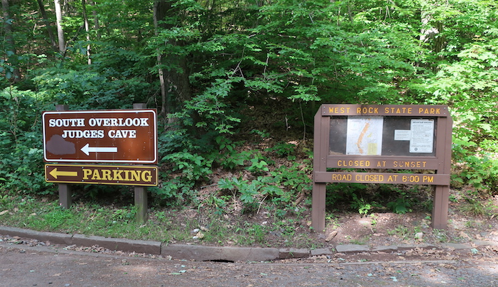 |
Once inside the main entrance, an arrow directs people up Regicide Drive (not named on any sign) to the South Overlook and Judges Cave, alongside the map board. The full name of the park is West Rock Ridge State Park, but the word ridge is missing from the sign, probably due to space limitations. |
- Thomas Darling House/Woodbridge Trails, 1907 Litchfield Tpke., Woodbridge: Indirect access to West Rock is available from Woodbridge by parking at the Thomas Darling House, 1907 Litchfield Tpke. (Rt. 69), Woodbridge. There is parking for about 20 cars in the dirt parking lot, plus room for another five cars on the shoulder at the trailhead.
- Directions: From the Wilbur Cross Pkway, (Rt. 15), Exit 46 (formerly Exit 59), then head north on Rt. 69 for 2 miles. Turn right into the parking lot just past the house. There is also parking available along the gravel shoulder of Route 69.
- Walk across the field into the woods and follow the blue trail into the woods, through an open field, across a wide bridge spanning the West River, then turn left on the blue trail to access the red-blazed North Summit Trail into West Rock. The Woodbridge blue trail should not be confused with the Blue-Blazed Regicides Trail.
- Sanford Feeder Trailhead, 176 Brooks Road, Bethany: The Sanford Feeder has a trailhead at 176 Brooks Rd. in Bethany. There are five parking spaces on the gravel shoulder north of the gate. Be careful when getting out of your car because vehicles whip around the sharp curve south of the gate. Turning around from the gravel shoulder is not a good idea for the same reason. Instead, continue north from the shoulder and do one of two things: turn left on Rowe Court, a dead-end street just beyond the next short turn and make a U-turn on that road, or continue north for half a mile, turn left on Carmel Road, and then left again on Downs Road if headed south.
- Directions: From Rt. 15, Exit 46 (formerly Exit 59), take Rt. 69 North for 3.3 miles. Turn right on Downs Road for 1.1 miles, then right onto Brooks Rd. for 1.1 miles. The trailhead is on the right. From I-84, take Exit 23 to Rt. 69 South for 11 miles. Turn left onto Hatfield Road to the end, then left onto Downs Road, then the next right onto Carmel Road, and the next right onto Brooks Road. Drive 0.5 miles and the trailhead is on the left. Be VERY careful turning around in this location due to the sharp curve. Using the area in front of the gate to make the turn is the best option.
- Walk up the Sanford Feeder to access the northern end of the Regicides Trail and Baldwin Drive.

From the north: Take I-91 South to Exit 12 (Route 5). Left on Route 5 South for 0.9 miles. Right on Route 22 for 0.9 miles. Turn right on Bishop Street (Following the signs for Route 15 South), then right again onto the parkway entrance ramp. Directions to specific parking areas are indicated above from Exits 46, 50, and 52 (formerly Exits 59, 60, and 62).
If you are going to the Blake Street parking, turn left into the parking lot and drive back toward the pedestrian bridge.
For Lake Wintergreen, follow these directions to the main entrance, but then go past the main entrance and the overpass for Route 15, go around the sharp bend, and up the hill to Main Street, just past Wintergreen School. Turn left on Main Street (Look for a small wooden "Lake Wintergreen" sign on the telephone pole). At the bottom of the hill, head straight into the parking lot. (Do this carefully because this is a blind curve and cars coming from the other direction can easily surprise you.)
No Parkway Signs for West Rock
I have twice asked the state Department of Transportation if it could install a brown sign on the Wilbur Cross Parkway to let motorists know to use Exit 50 (then Exit 60) (Dixwell Avenue) to access West Rock, and in my first request, to use Exits 61 or 62 (changed to Exits 51 and 52 in July 2025) for Sleeping Giant. Both requests were denied, but for different reasons.
The first time was in August 2011 and the reply was that there were already too many informational signs near those exits. There really were not too many signs of any type, and, in fact there are hardly any signs in this area.
The state did agree to install a brown sign at the end of the exit ramps pointing the way south on Dixwell Avenue for West Rock and north on Whitney Avenue for Sleeping Giant. Still, people would need to know to use Exit 60 (now Exit 50) to see this sign for West Rock.
As part of that original request, I noted that one of those signs was for the for-profit Paier College of Art. The college moved Bridgeport in fall 2021 and shortened its name to Paier College and closed its door in 2024. Following the move, Paier contacted the state to remove the signage on the parkway and its ramps.
In November 2022, I decided to try again, focusing on just West Rock, figuring that maybe different people were working for the DOT and that someone else might give a positive answer. Nope. The request was again rejected, but this time for a different reason.
The DOT person who responded referred me to the DOT’s “Signing Guidelines”, which prohibits on any parkway “tourist attraction signs,” i.e., those blue signs that list the names for businesses and parks. The guidelines were adopted in November 2012 and last revised in February 2020.
Link: https://portal.ct.gov/-/media/DOT/documents/dtrafficdesign/SigningGuidelinespdf.pdf
The DOT does permit these signs on interstates, which is why there are signs on I-95 for places like Hammonasset State Park, and various businesses.
In my response, I pointed out that there are existing green signs along the parkway for some places that would fit the definition of attractions, such as the sign for Southern Connecticut State University at Exit 60 (now Exit 50) or for the Toyota Oakdale Theater at Exit 64 (now Exit 58A).
The DOT commented by saying that as signs are updated along the parkway, the new signs would have to conform to the regulations, meaning signs like the SCSU one and the Oakdale one would likely be removed.
I agree that there should not be commercial signs on the parkway that advertise businesses. However, I think there should be signs for state parks and for universities, public or private.
In the DOT response, they also commented that the DOT did not see the need for the signs because people would likely use GPS to reach the park.
I checked Apple, Bing and Google maps to see if I requested to go to West Rock Ridge State Park where it would bring me. The Apple app and both websites used Lake Wintergreen as their destination. This is good to know because the park’s entrance on Wintergreen Avenue is only open five months of the year and there is no parking by the entrance any time of year, other than the small lot at the West Rock Nature Center.
How do you access red trail from Common Ground High School?
ReplyDeleteFollow the Red-White Trail (which has Red Diamonds in a white background) from the school. The connection is short and the two trails briefly overlap.
ReplyDeleteIs there parking at the purple trail head?
ReplyDeleteThere is no official parking there. The road is two lanes without a shoulder and if someone parks along the road, they will block one of the lanes. This is only about half a mile from the Lake Wintergreen parking area, which is the main parking lot for the park.
ReplyDelete